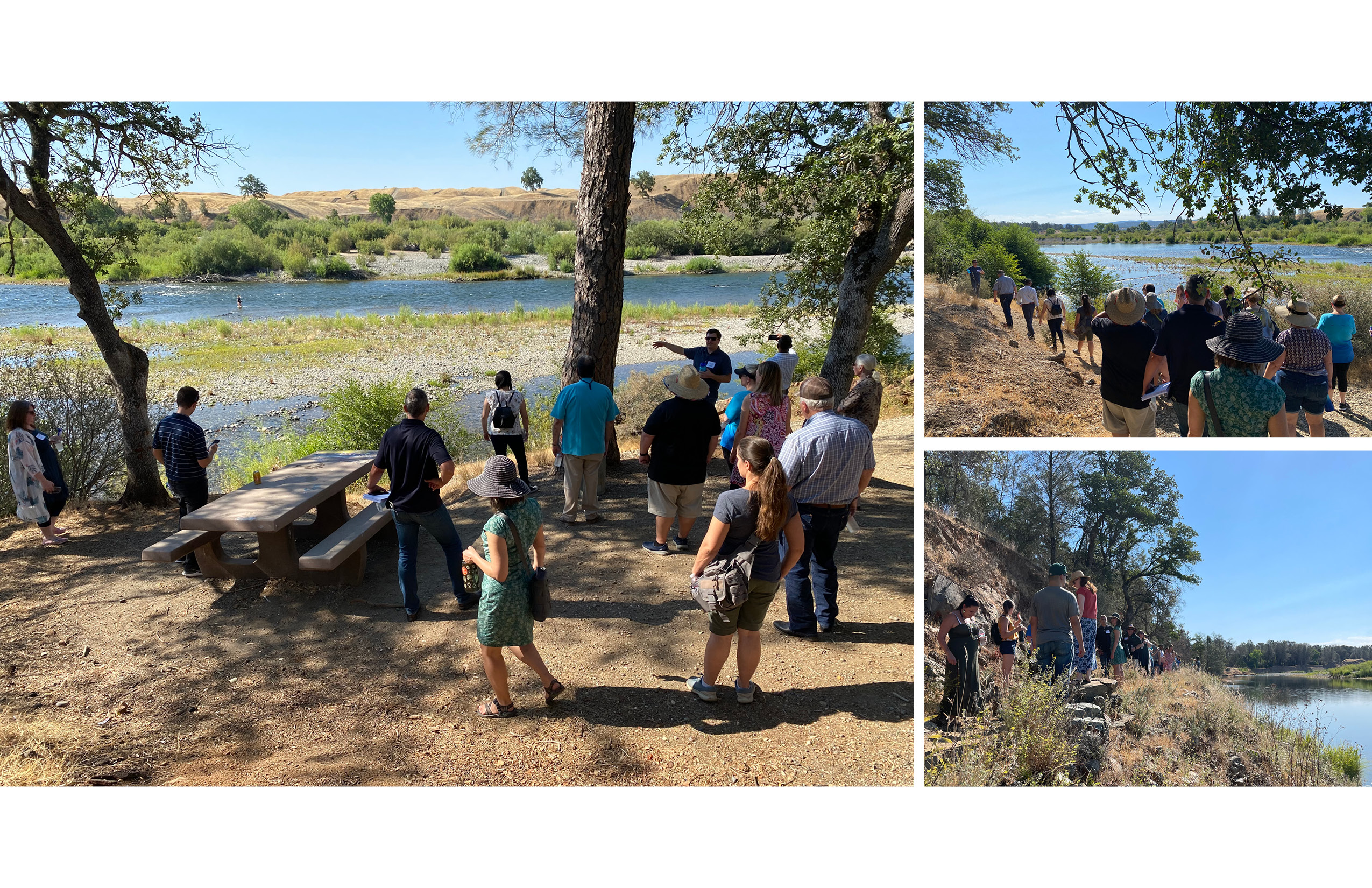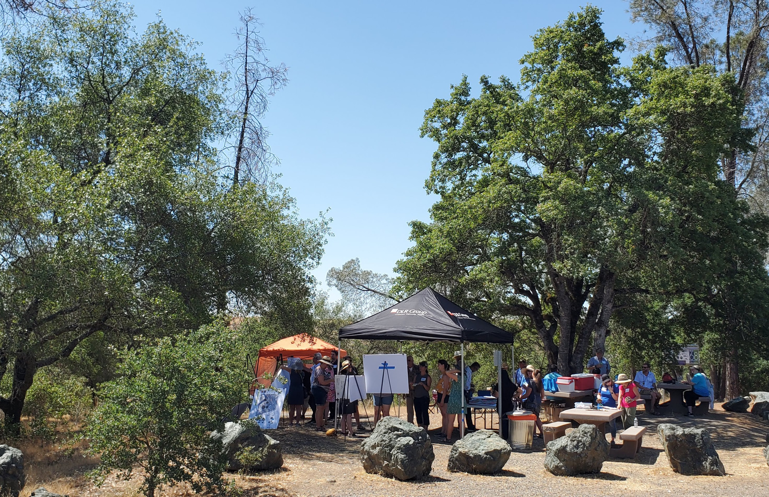
about the project
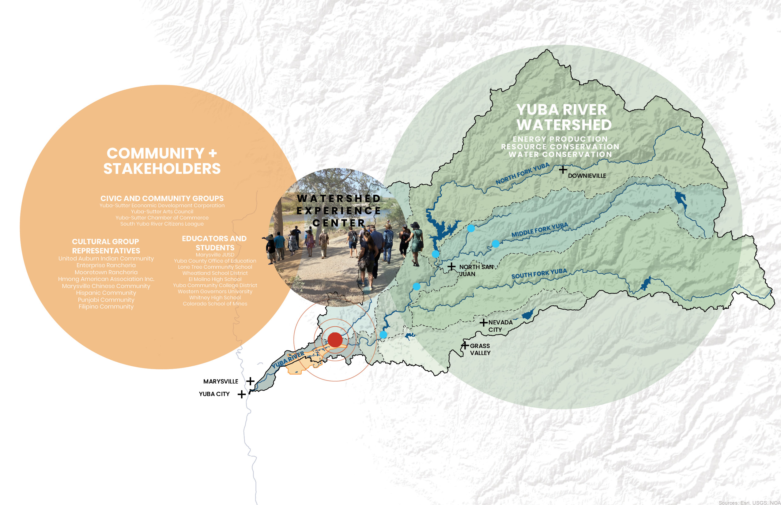
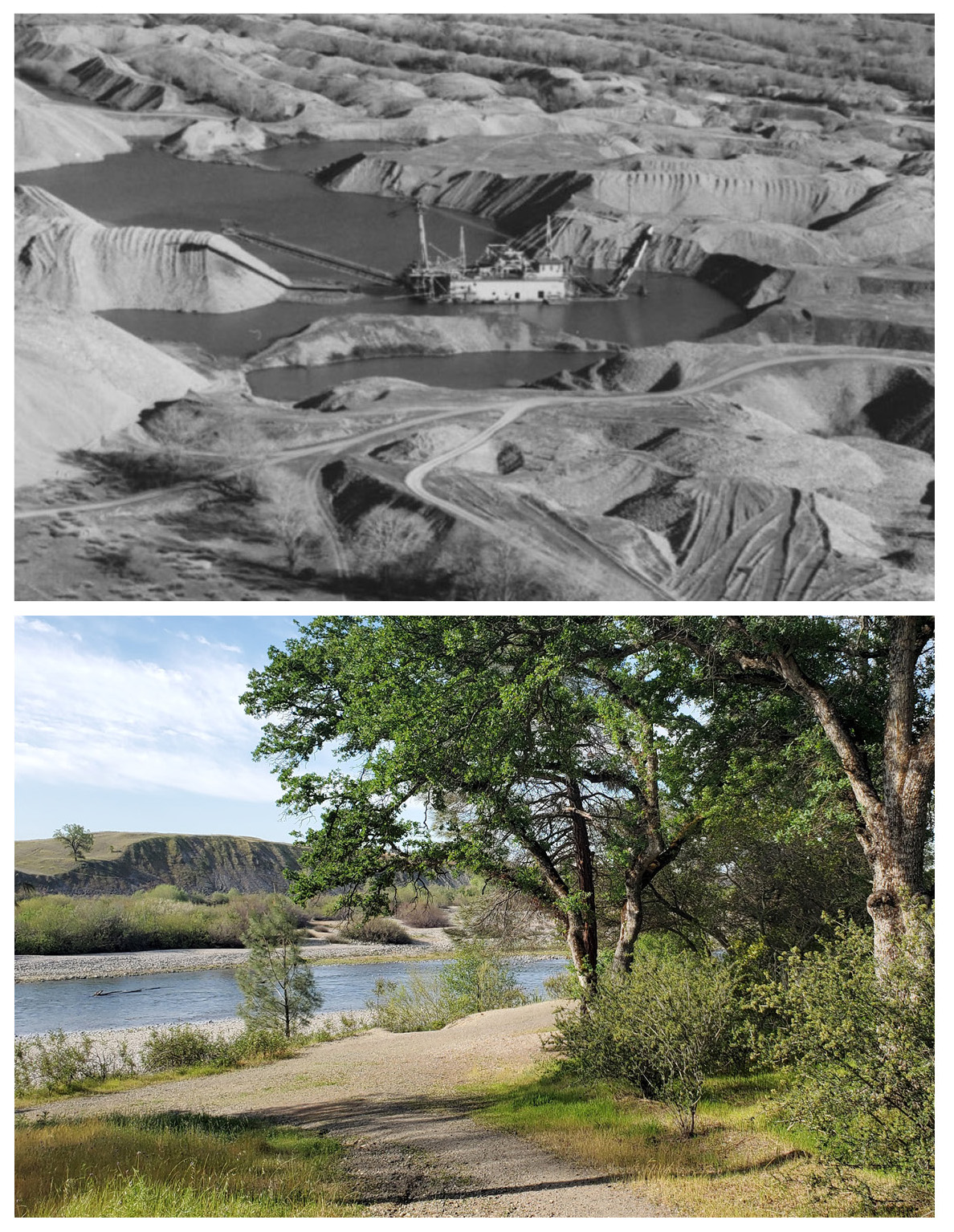
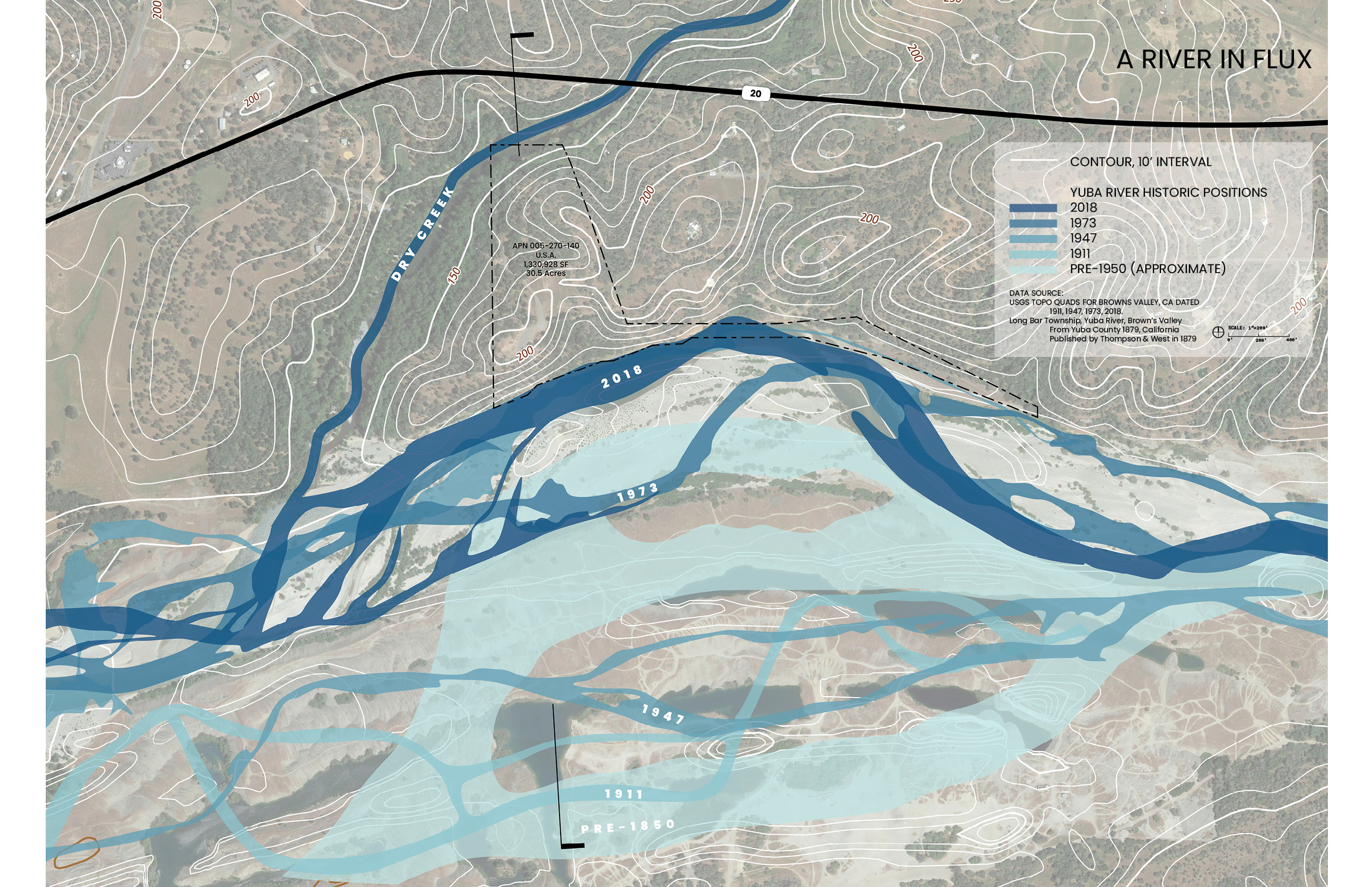
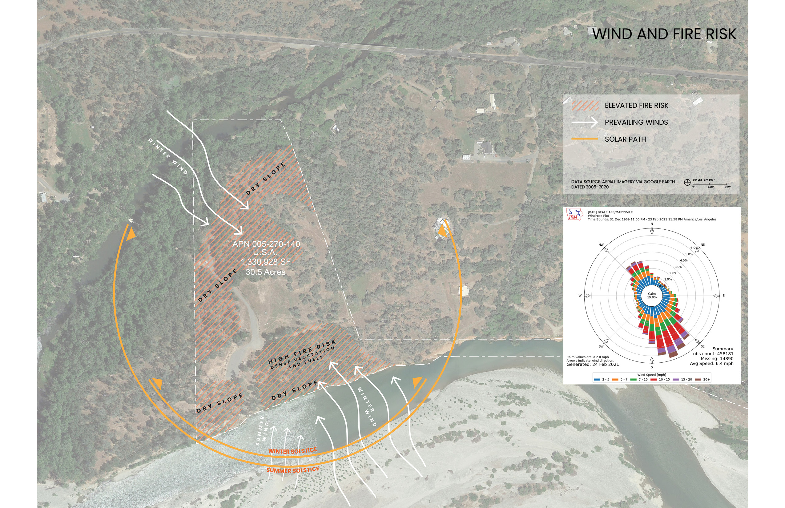
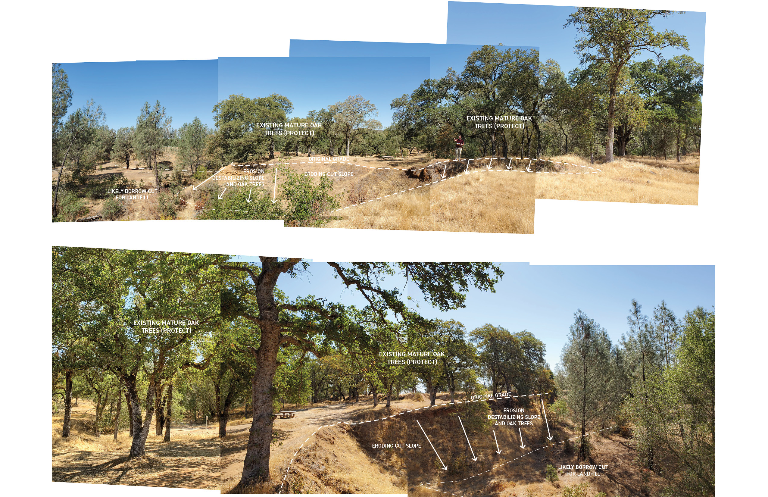
Hammon Grove Park is situated along the Yuba River, just east of Marysville and directly across from the historic Yuba Goldfields. This site occupies a pivotal point in the watershed, where the river transitions from the slopes of the Sierra foothills to the flatlands of the Sacramento Valley. The landscape bears the physical and ecological imprint of this transformation, shaped by a complex history of mining, erosion, and river redirection. Once a meandering river weaving through fertile bottomlands, the Yuba was profoundly altered by hydraulic mining during the California Gold Rush. Massive sediment deposits—some as deep as 30 meters—filled the river’s natural floodplain, turning it into the largest gold dredge field in California. Between 1904 and 1968, over one billion cubic yards of sediment were dredged, pushing the river’s course northward by more than half a mile and carving a deep, narrow channel along the southern edge of Hammon Grove Park.
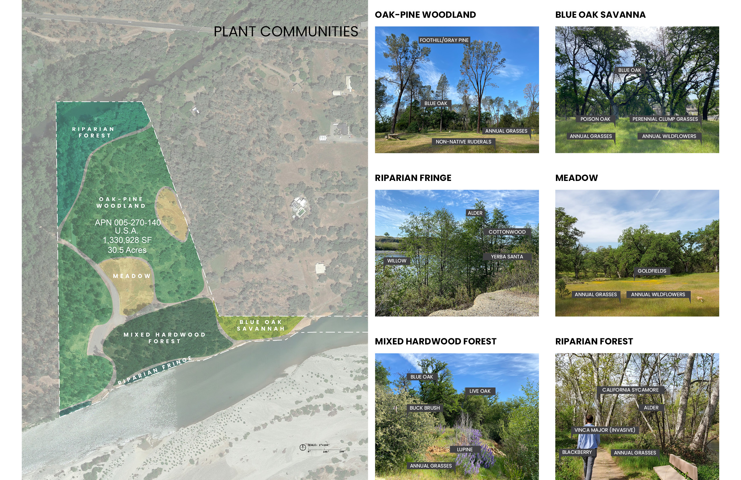
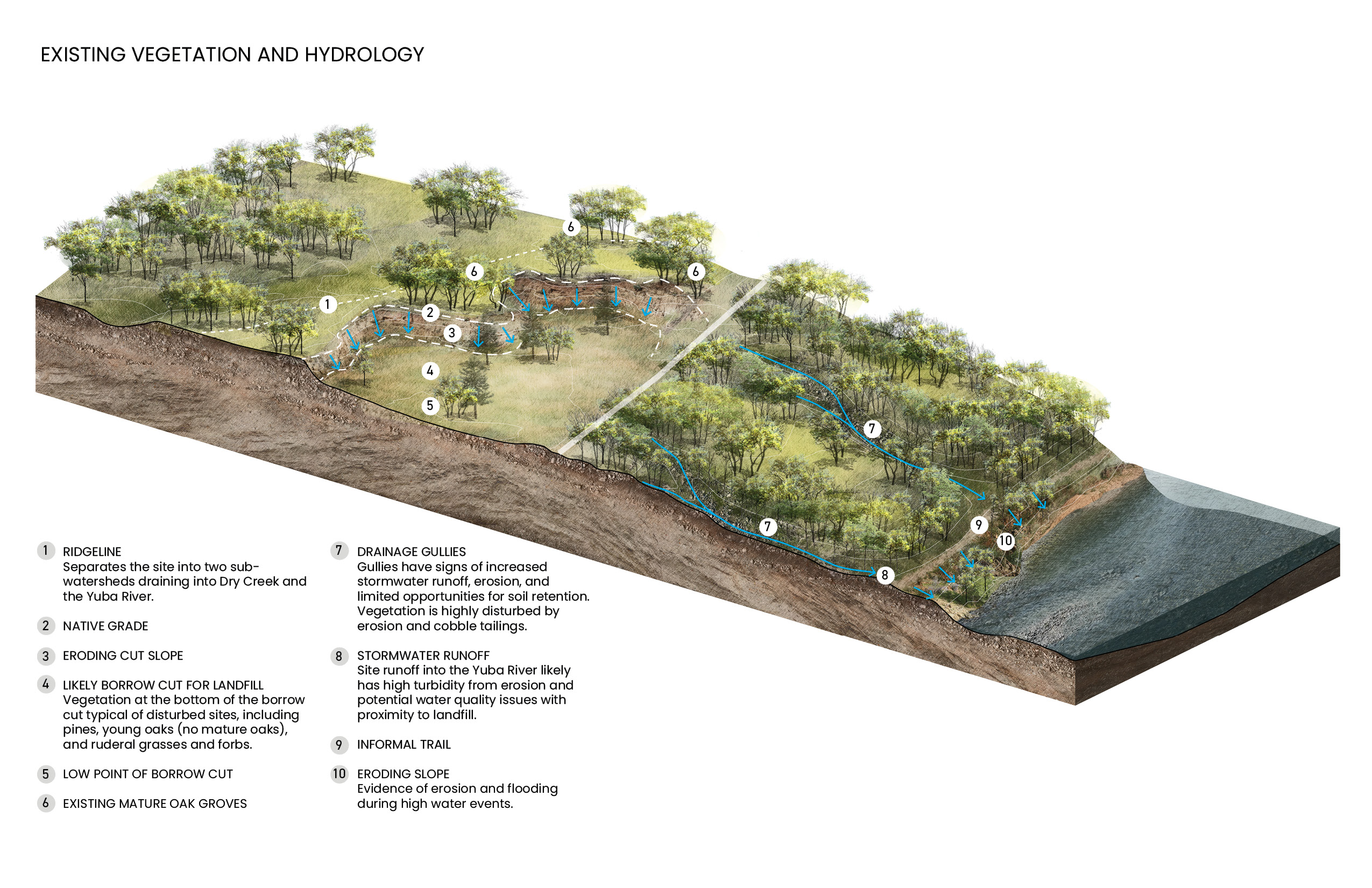
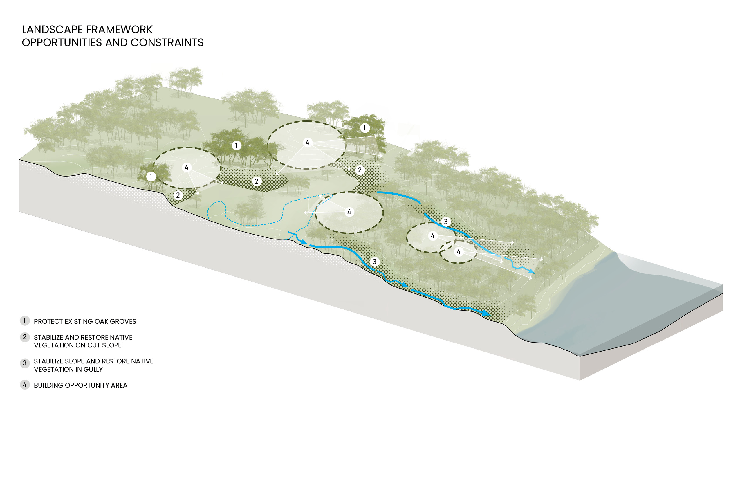
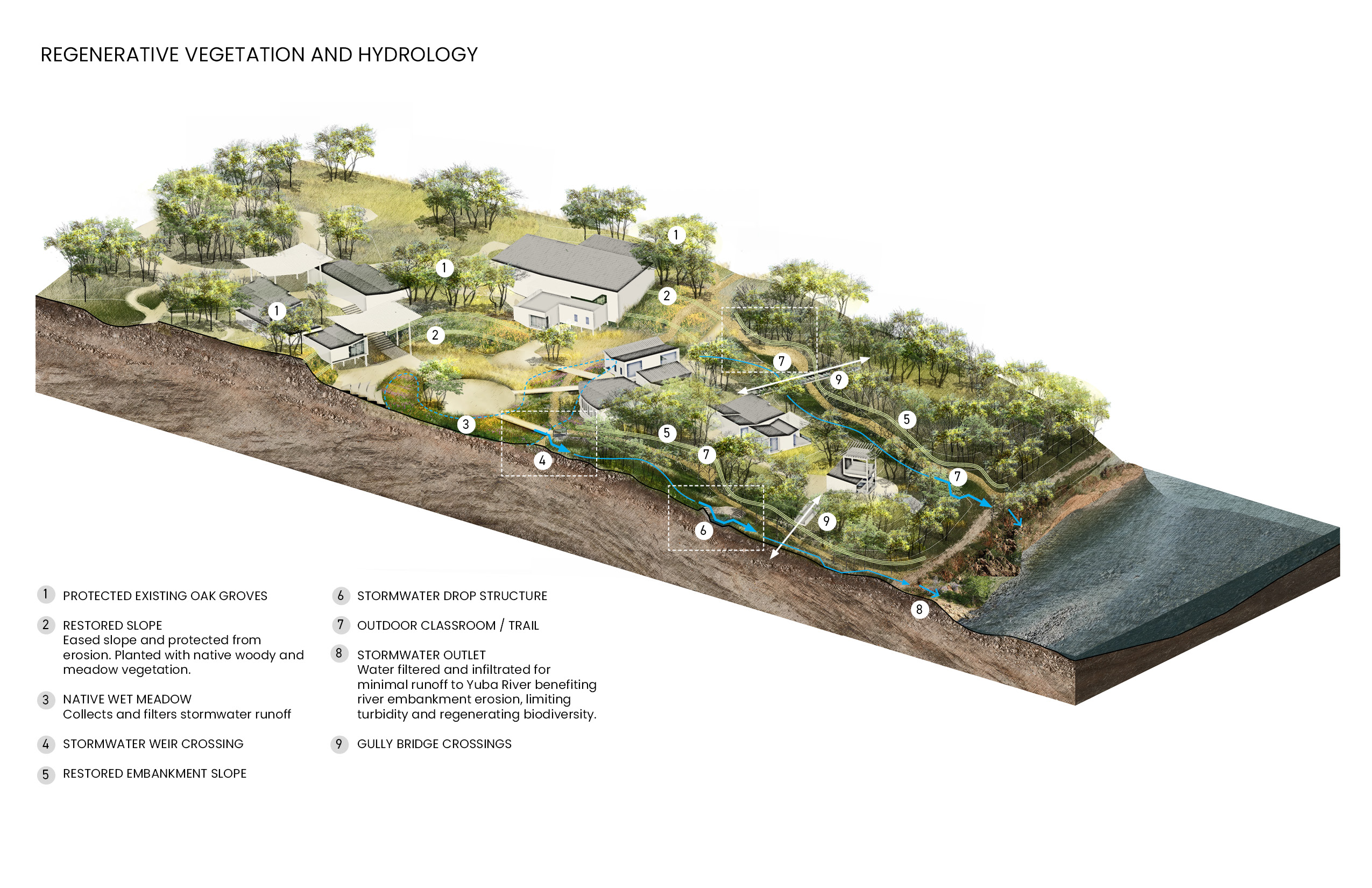
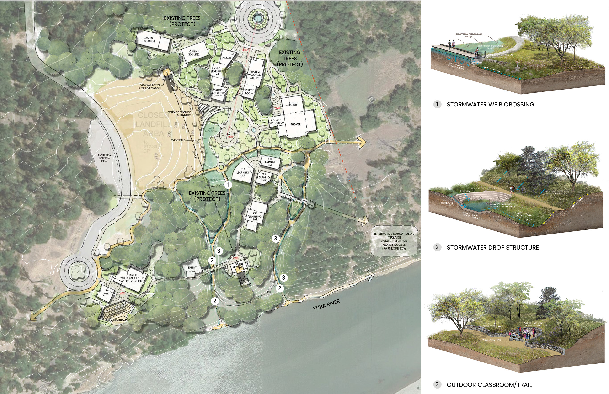
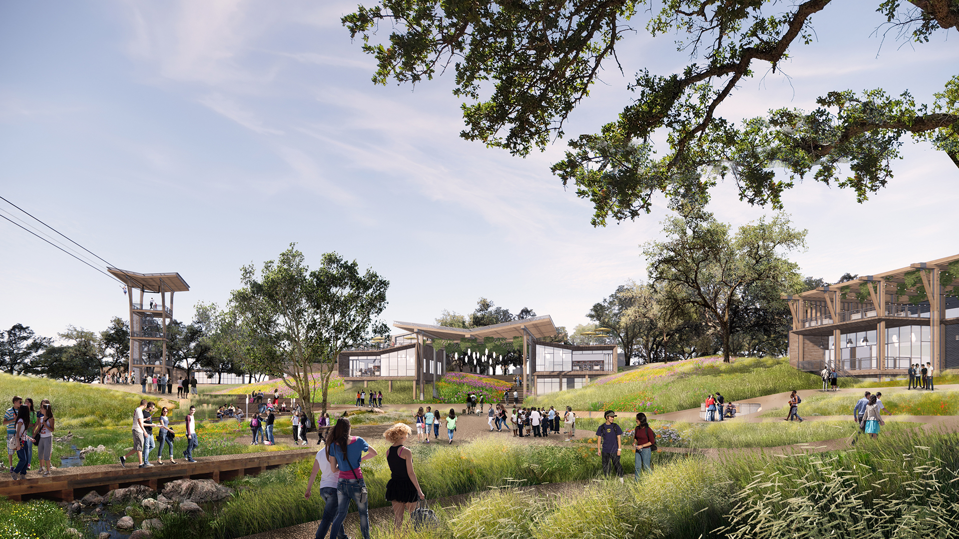
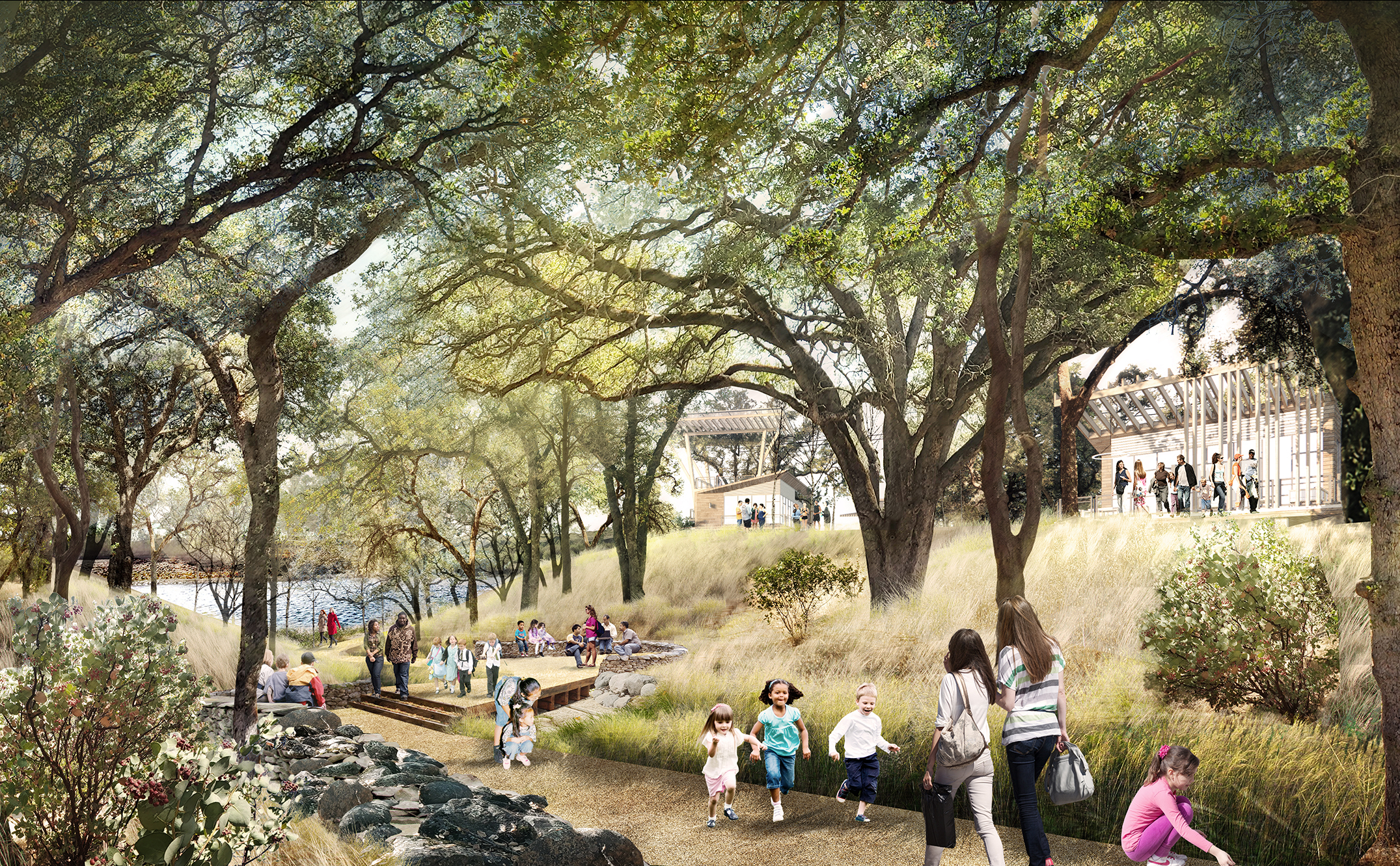
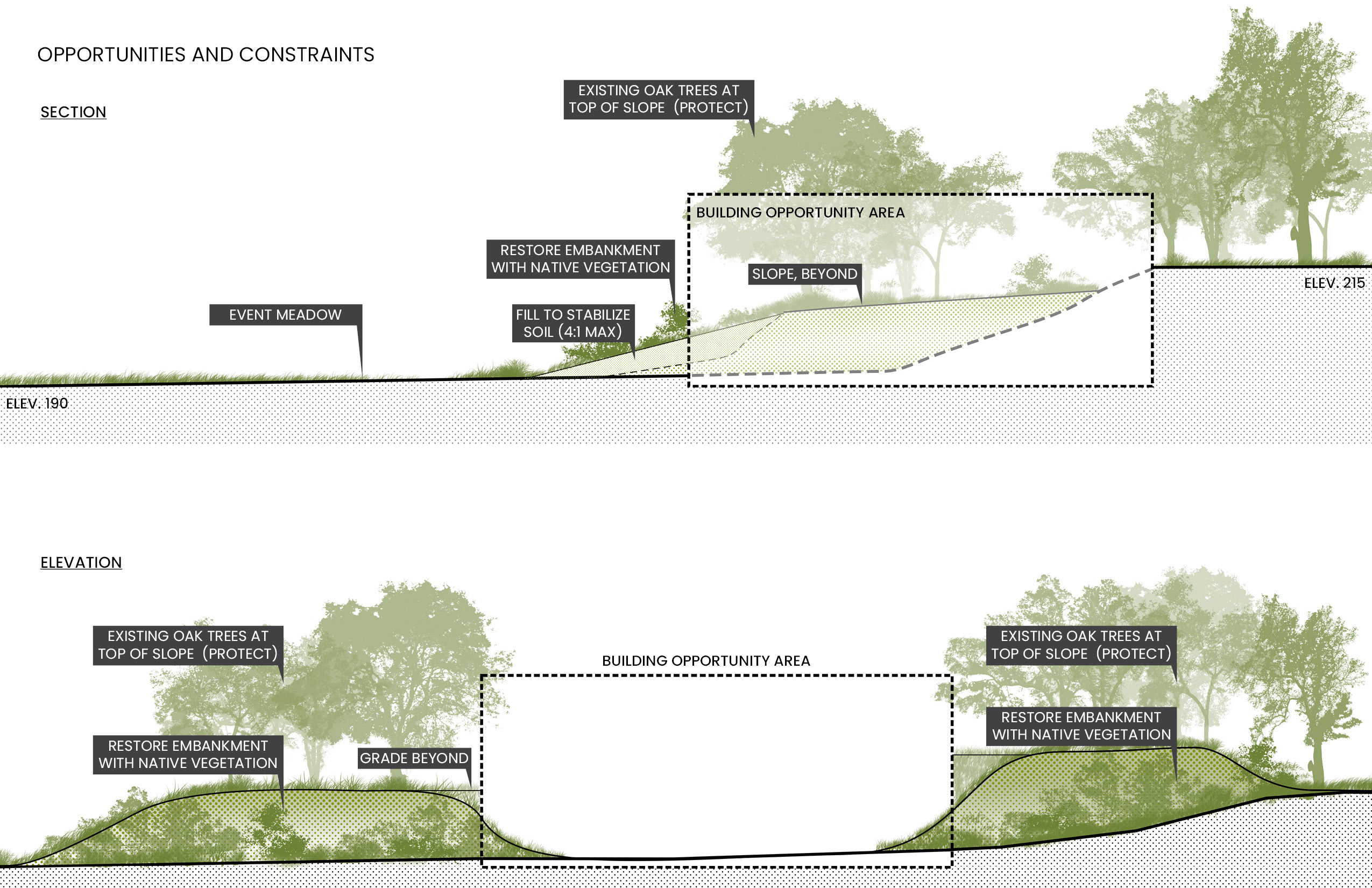
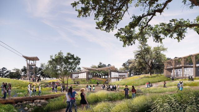
The Master Plan for the Yuba Watershed Experience Center, situated within the park, seeks to restore ecological integrity to this disrupted landscape. Developed with a restorative framework, the plan protects mature oak groves, stabilizes eroding embankments, and re-establishes native vegetation. These interventions enhance stormwater quality, promote biodiversity, and create a didactic landscape—one that tells the complex story of mining history, hydrology, and ecological resilience. The site features a diverse set of educational and recreational amenities, including accessible trails, outdoor classrooms, an amphitheater, a zipline, and a treehouse, all carefully nestled within the iconic blue oak savannah. Designed to balance public access with educational programming, the master plan creates spaces for community events while also accommodating school field trips and research groups ranging from kindergarten to post-graduate levels.