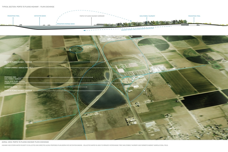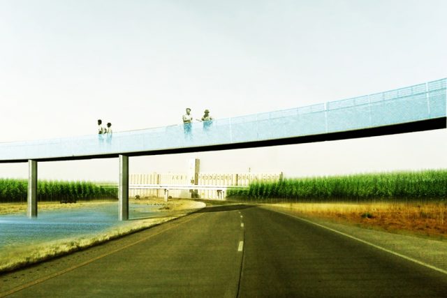
about the project
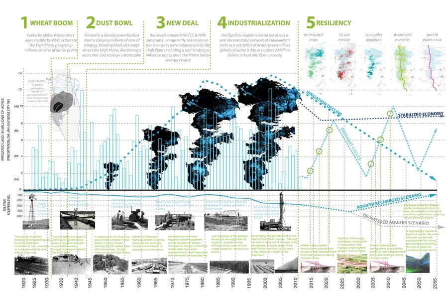
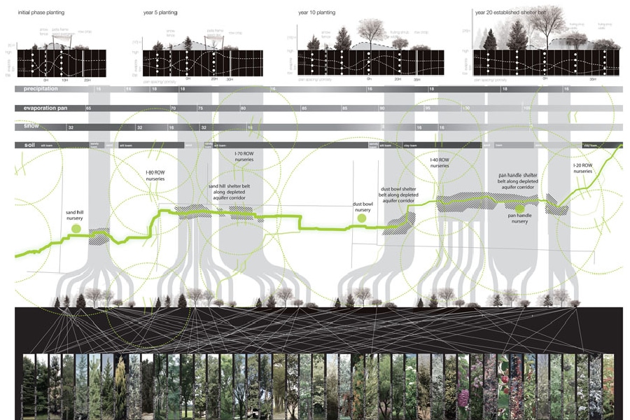
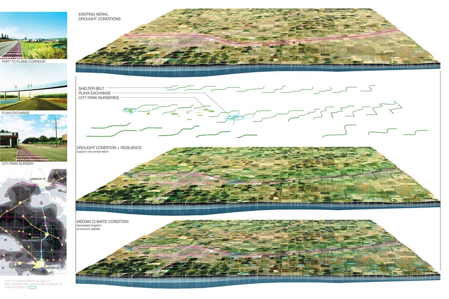
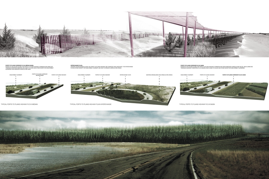
The Ogallala region is more than 90 percent privately owned with diverse ownership of the aquifer, a singular engineered or preservation based regional master plan to “save” the aquifer and sustain the region is wrought with problems. The project is not an attempt to save the aquifer but instead is a landscape strategy that seeds resilience for the aquifer dependant agriculture and couples these strategies with the dominant infrastructure investment of this region, the highway. This project builds upon a proposed highway trade corridor, the Ports to Plains Corridor, from Laredo, Texas to Denver, Colorado. Resilience in the Right of Way activates the Ports to Plains Corridor Right of Way, as an area of opportunity to mitigate the region’s potential crisis by initiating two principle strategies: 1) through storm-water capture and 2) the establishment of shelterbelts. In this scenario, the Right of Way is articulated to capture, treat and release water for the establishment and distribution of shelterbelts for the region. The proposed Port to Plains corridor intersects and transforms with the local conditions across the diverse longitudinal climate conditions to provide an infrastructural framework to crystallize resources and community, and provide the impetus for social, ecological and functional resiliency in the landscape. No longer linear, transportation networks become ecological frameworks —generating new urban ecologies, morphologies and multiple nodes of mobilities that support contemporary urban life.