about the project
In 2017, on behalf of BARC, MTC submitted a successful Caltrans SB1 Climate Adaptation grant application to further advance concepts of the Grand Bayway developed for the Resilient by Design Bay Area Challenge (RBD). An SB1 Project Management Team (SB1PMT), managed by BARC staff, with representation from MTC/ABAG, BCDC, Caltrans and the State Coastal Conservancy (SCC) selected The Grand Bayway proposal by team Common Ground (1 of 3 RBD sites) for further study and allocated $200,000 to advance important goals related to mobility, public access and public outreach within the San Pablo Baylands, based in part on concepts identified by the Common Ground team during the RBD Challenge.
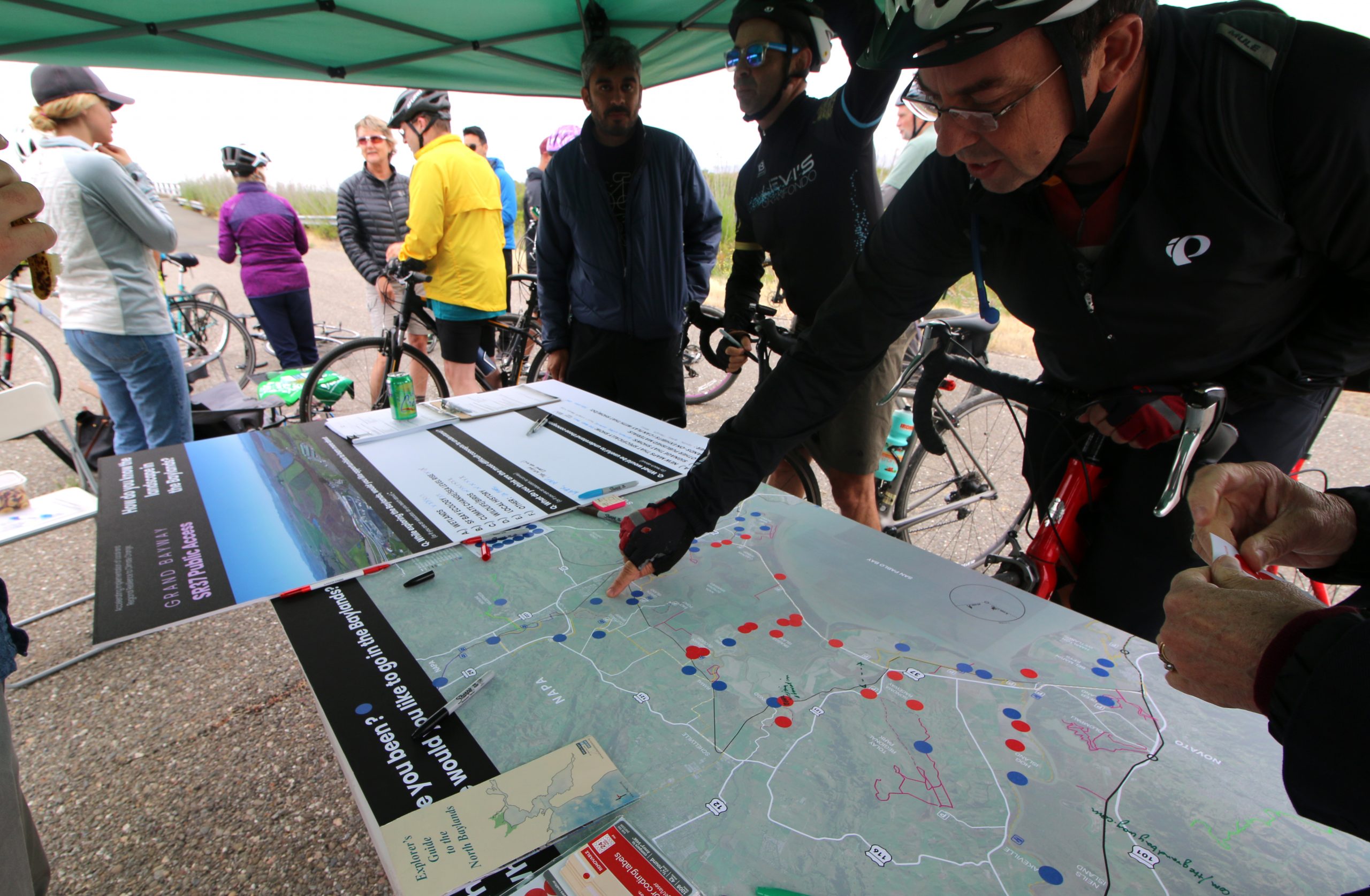
The development of the San Pablo Baylands Public Access Scoping Report has been compiled in close coordination with the SR37 planning efforts – both near-term and long-term improvement considerations. Updates used in this report are shared with the 4-County Policy Committee and MTC. Various public events and focused discussions with key stakeholders have occurred throughout development of the San Pablo Baylands Public Access Scoping Report utilizing a Local Working Group that includes representation from access advocates and agencies, restoration scientists, landowners and members of the Vallejo community.
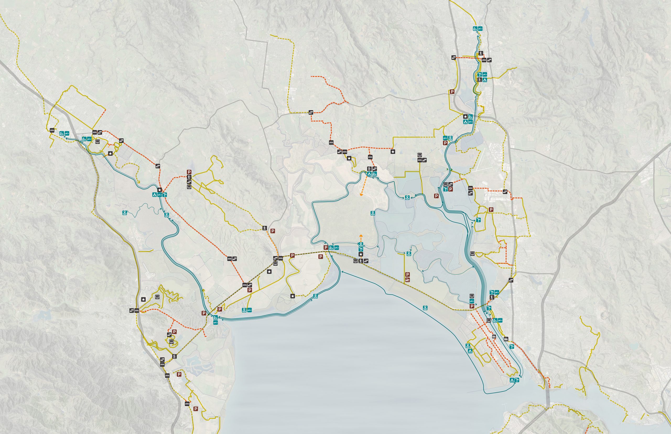
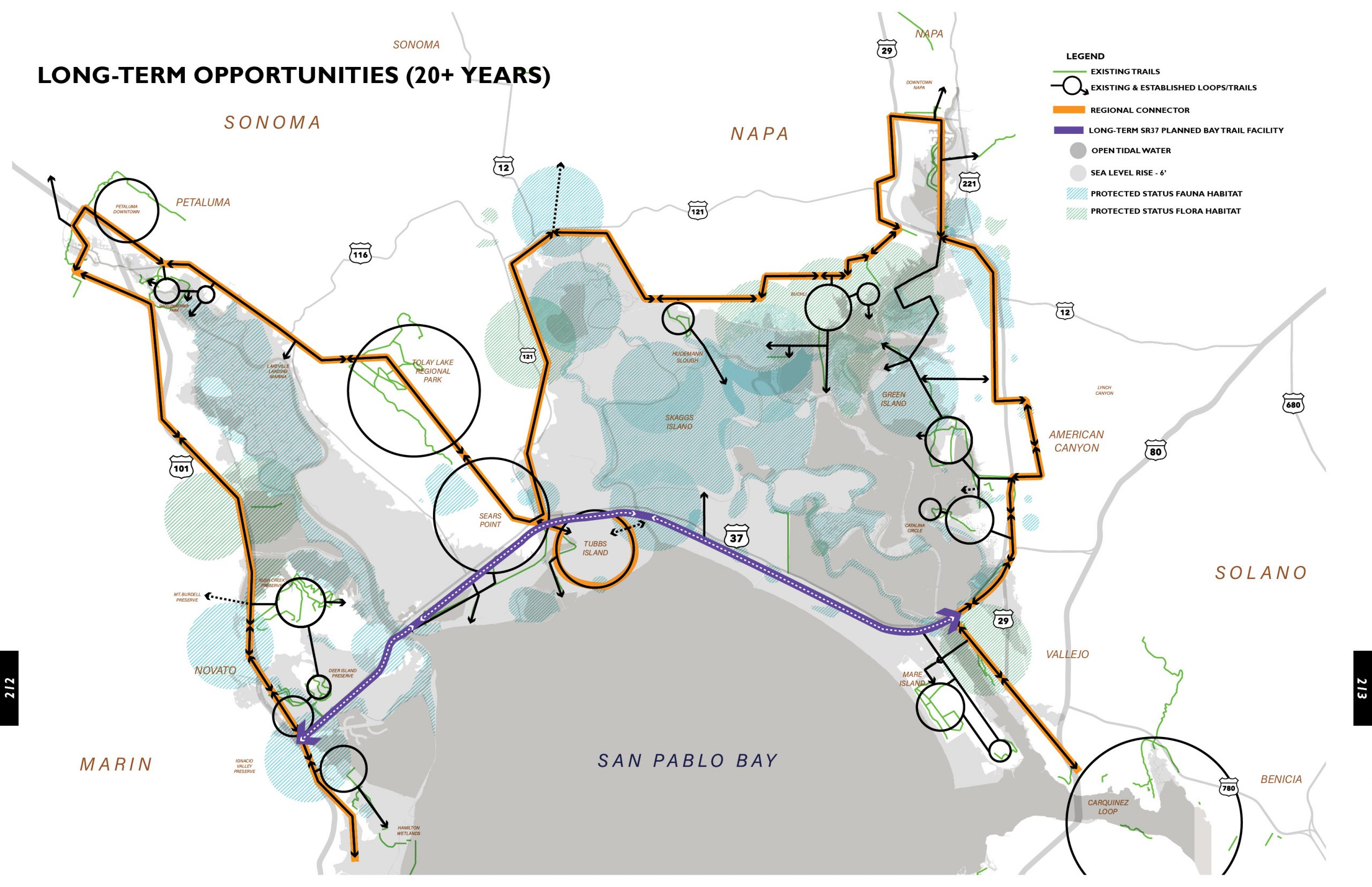
The mission of the project is to connect a safe and world-class active transportation corridor along SR37 with a network of recreational opportunities (land and water based) along the San Pablo Baylands for people of all ages and abilities that enhances awareness of the Baylands, the protection of sensitive wildlife area, enhanced regional connectivity and provides:
• Resilient connections coordinated across jurisdictional boundaries
• A wide-range of equitable access opportunities
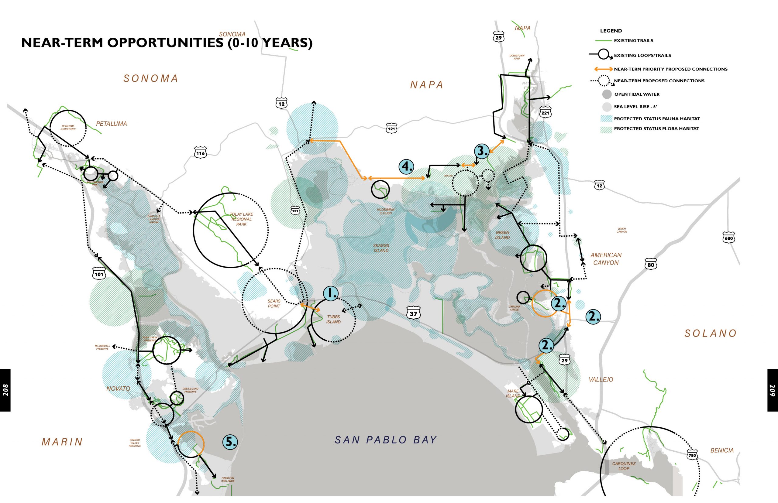
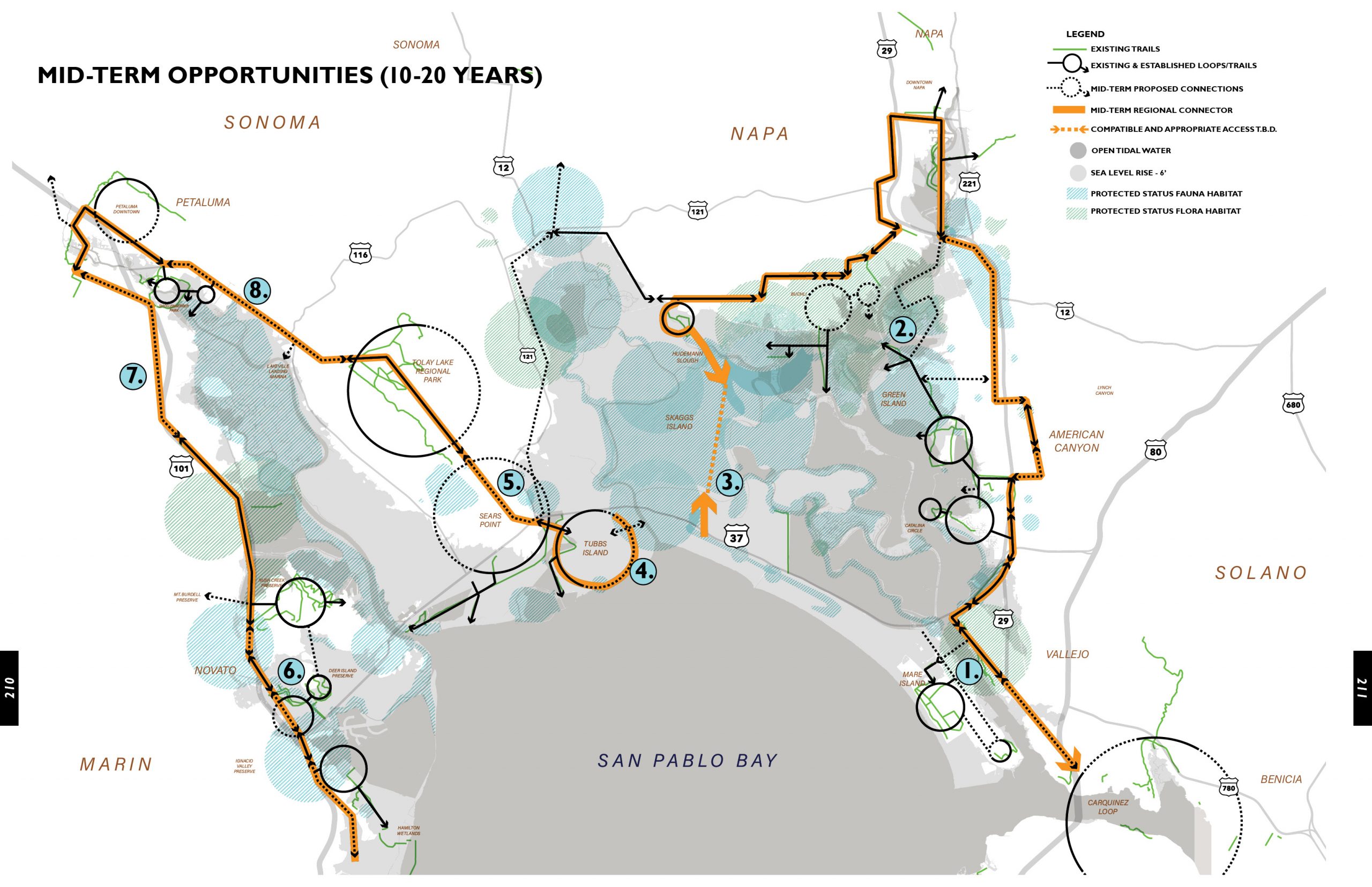
• Opportunities for access in the near-term (5-20 years)
• Increased awareness and environmental education
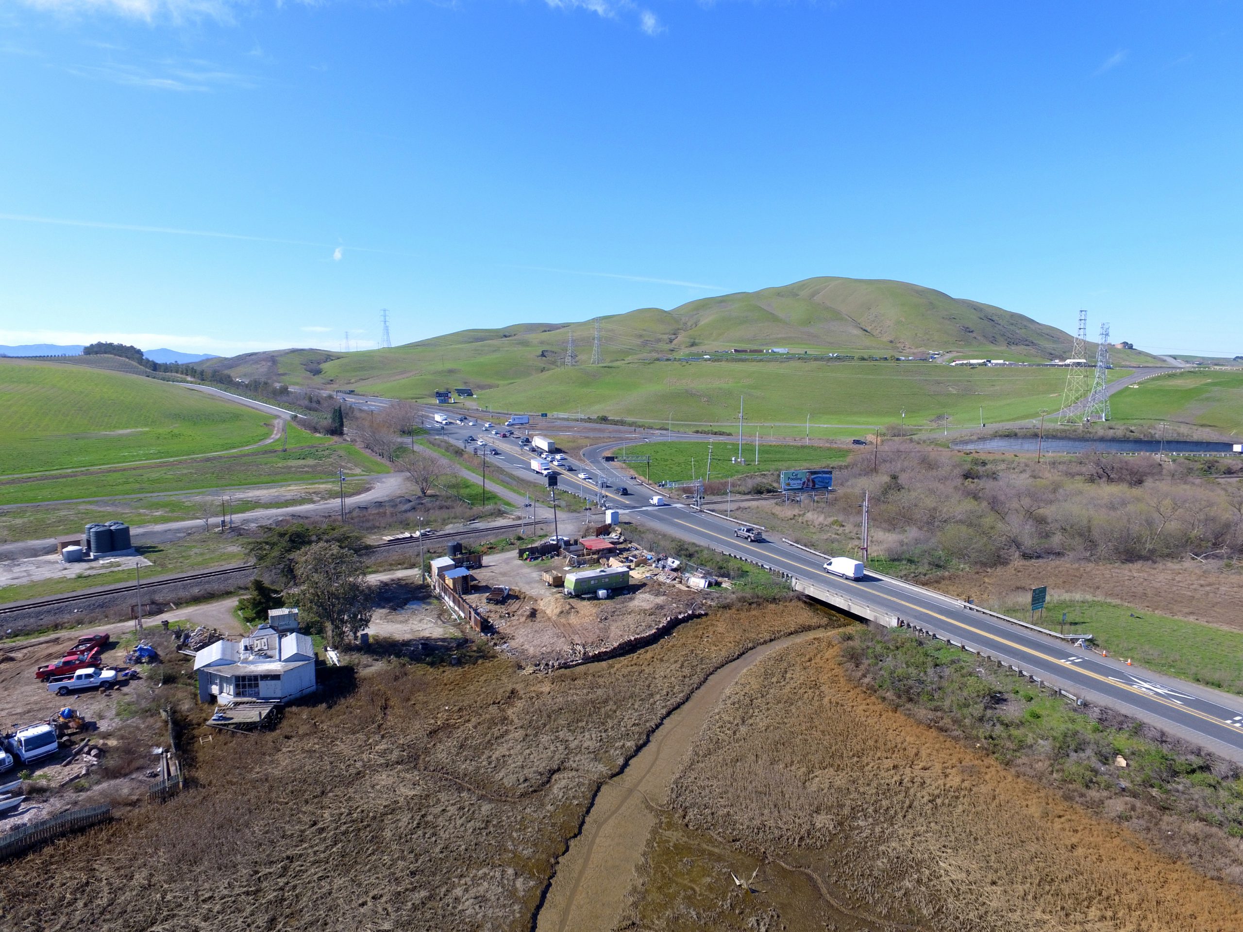
A phasing strategy is vital to access planning in this region. Most of the study area projected to be inundated by Sea Level Rise and many areas are planned for large scale restoration or are in various stages of restoration. Access might be reasonably supported for the next 50 years with a gravel trail on a levee but by 2100 those levees might be breached – through a storm event or a yet to be planned restoration. The future scenarios for Sea Level Rise and any successful restoration habitat (upland, open water or marsh) are extremely complicated and difficult to model or predict at this point. Having a strong framework tied to the guiding principles of connectivity, equity and resiliency are critical so that routes make impactful near-term access that may adapt overtime yet still provide continuous access.