about the project
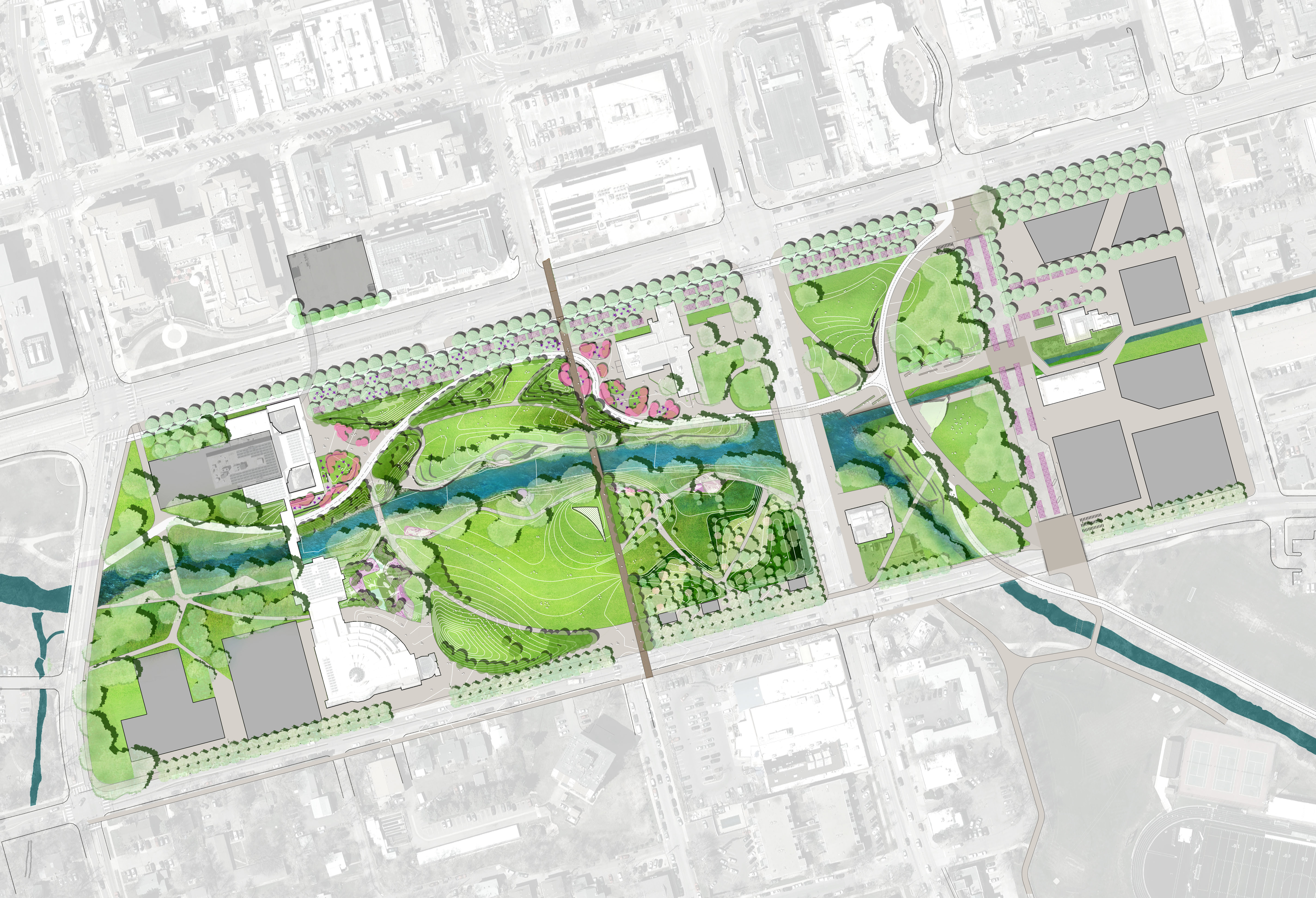
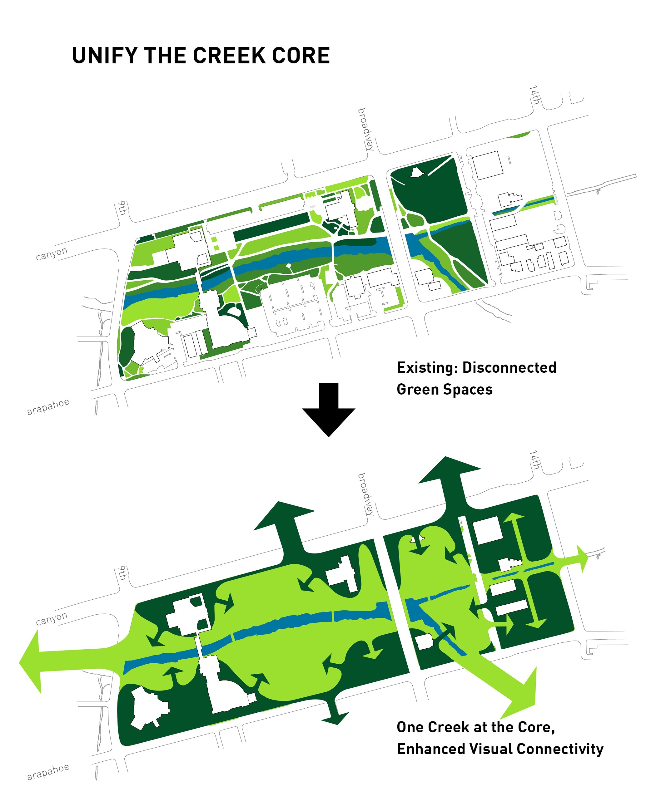
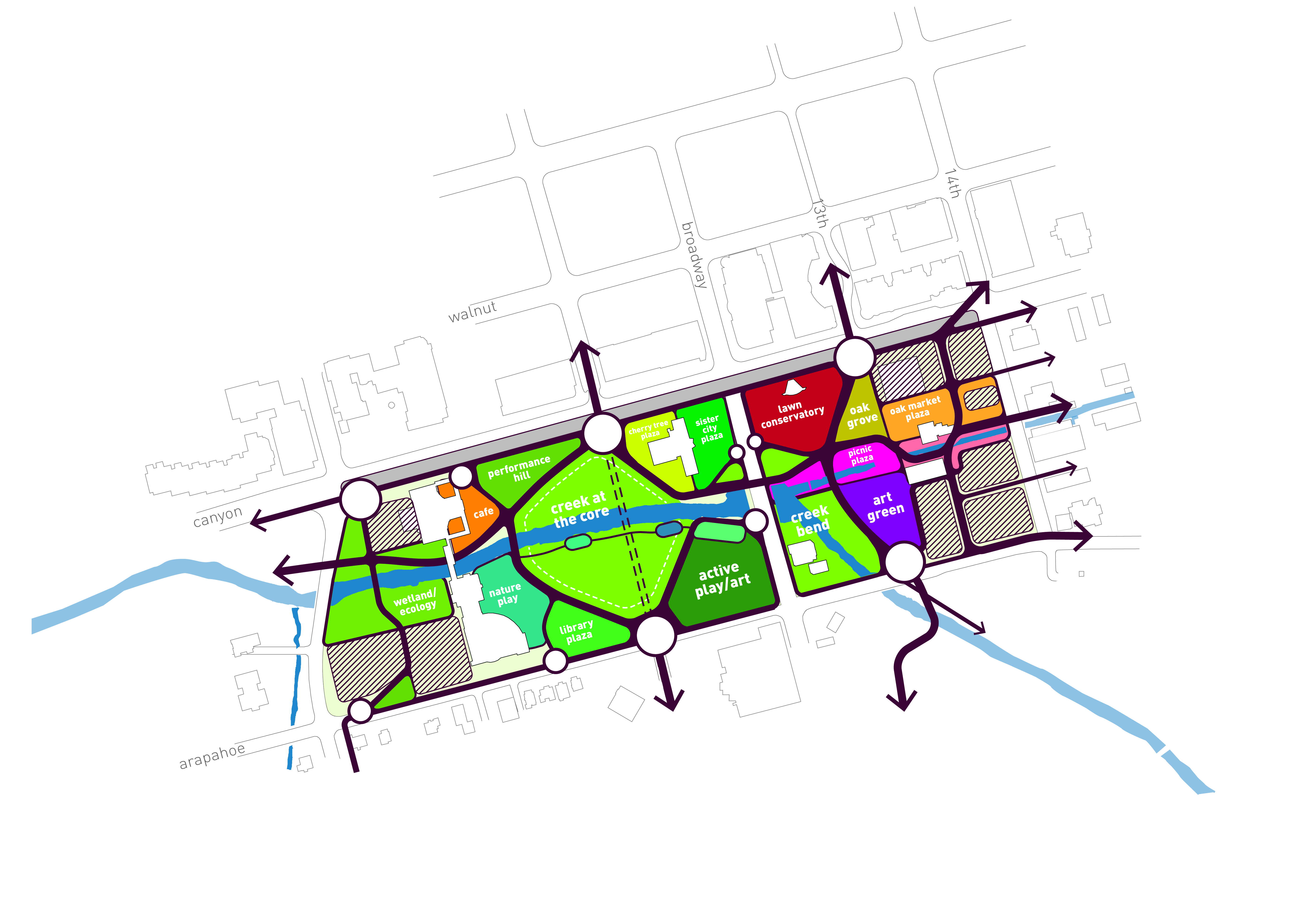
The Master Plan articulates a unified park-core along Boulder Creek, expanding experiences along the Boulder Creek Path and flanking the urban grid with bookends of activating civic, cultural, and commercial buildings. The plan provides for a variety of experiences and strategic connections to key portions of the city – revealing the site’s lost natural history while creating a lively and distinct destination that reflects the community’s values. Values where people of all ages, abilities, backgrounds, and incomes feel welcome to recreate, socialize, deliberate, learn, and access city services.
The green space along Boulder Creek will provide significant open space and will be the unifying design that weaves existing and new facilities with a rich diversity of civic, commercial, recreational, artistic, cultural, and educational amenities and programs. The plan maintains beloved places – theDushanbe Teahouse, the Boulder Public Library, the Farmers’ Market and City Offices, yet identifies future facility needs and makes more space for art, food and cultural uses that provide more 24/7 activation. All together, these elements create a true civic heart for the Boulder community, a place where the city’s past, present, and future are debated, celebrated, and realized.
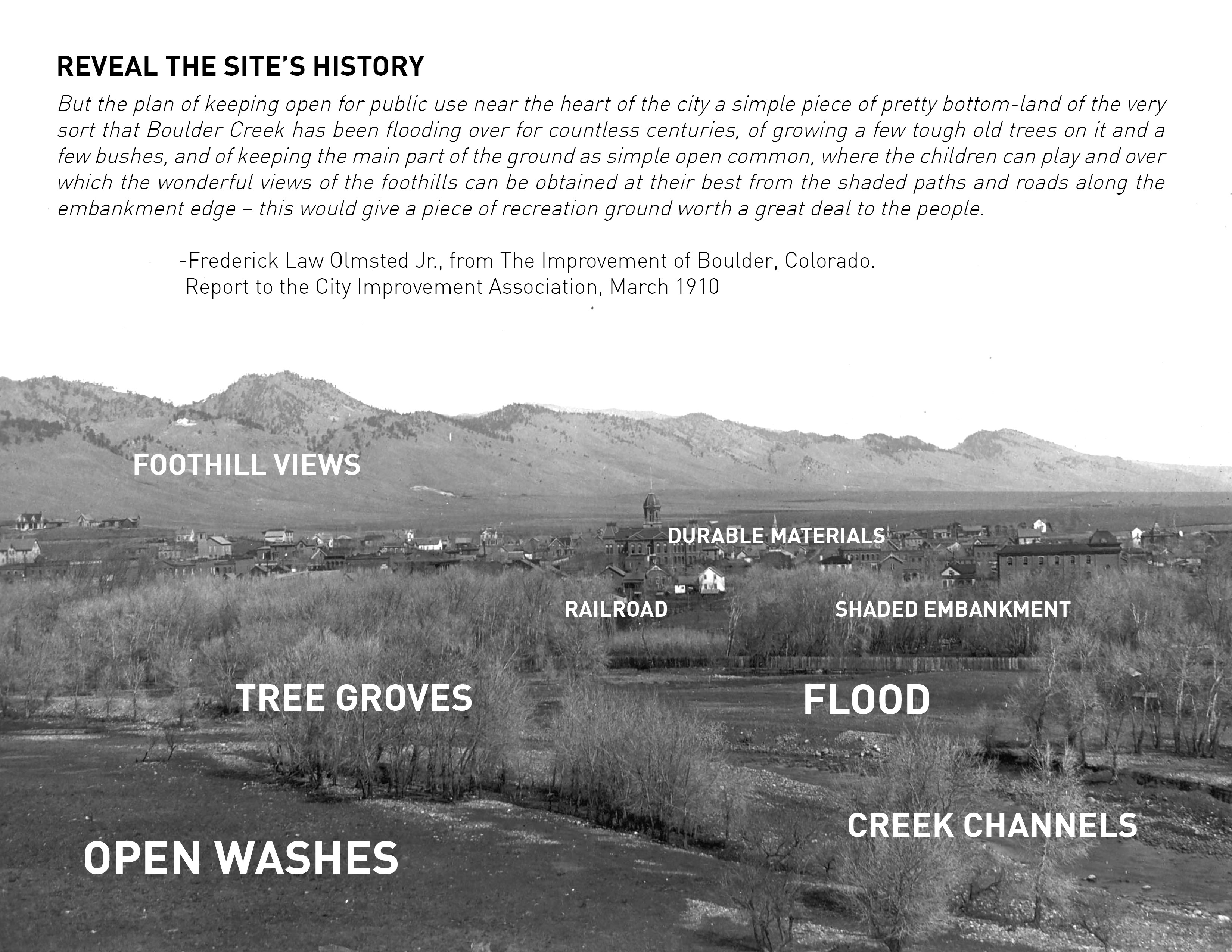
The Master Plan is located within the 100-year floodplain, and much of the land lies within the High Hazard Zone (HHZ) and Conveyance Zone. The plan works to phase out buildings and surface parking that are at risk in the HHZ and is proactive about restoring open space allowing for “room for creek” flooding. The restored flood plain “washes” are modeled to provide resilient pedestrian connections, structures and native planting eco-tones, while enhancing the experience and safety of the community. The park will provide a new urban experience of the creek with re-interpreted landscape akin to what Frederick Law Olmsted Jr. described in his 1910 report for Boulder as the “washes” of Boulder creek.