about the project
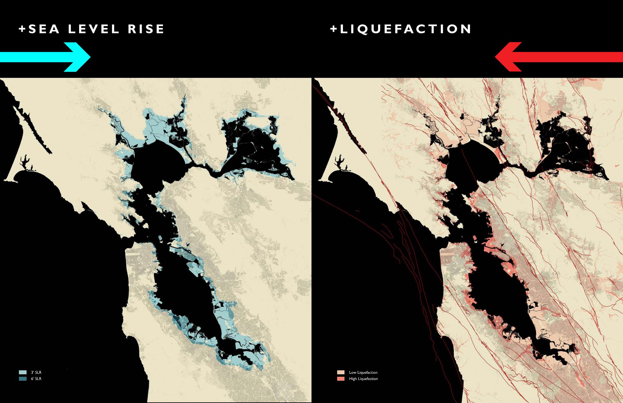
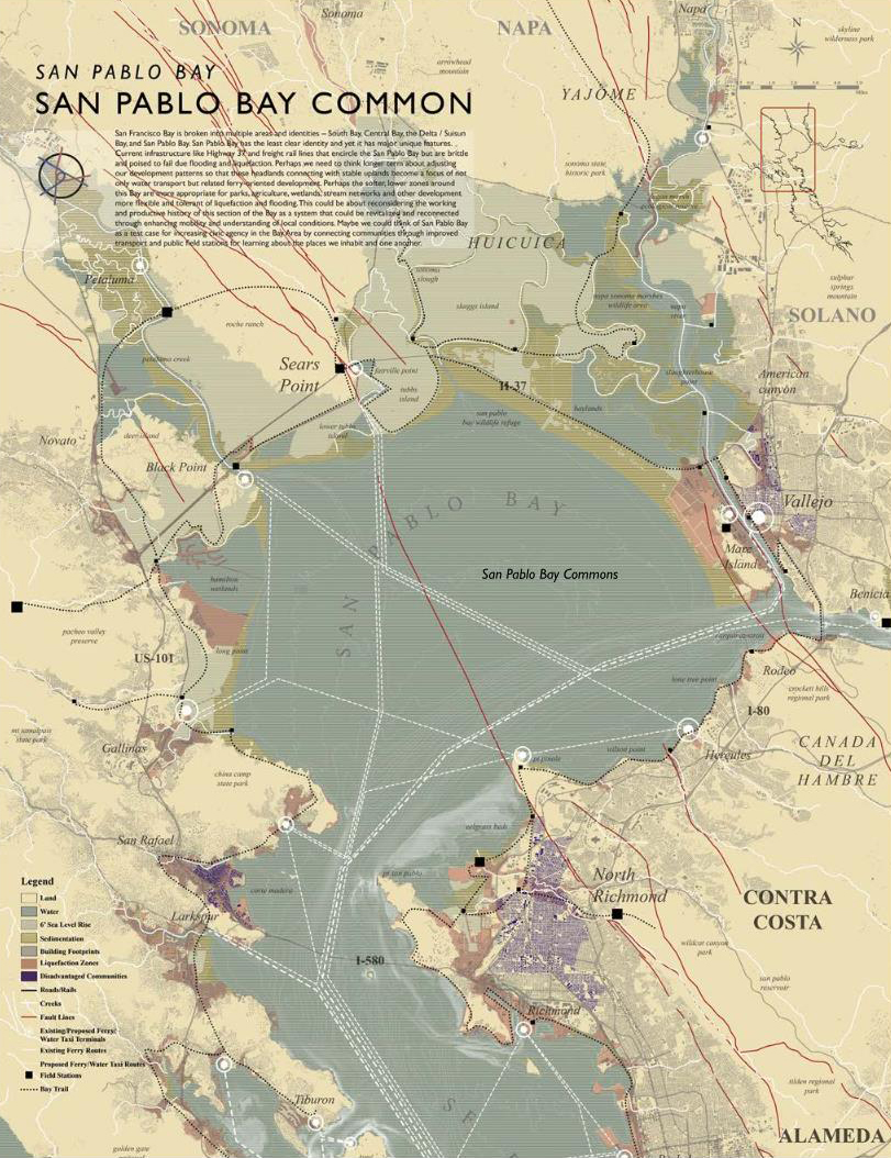
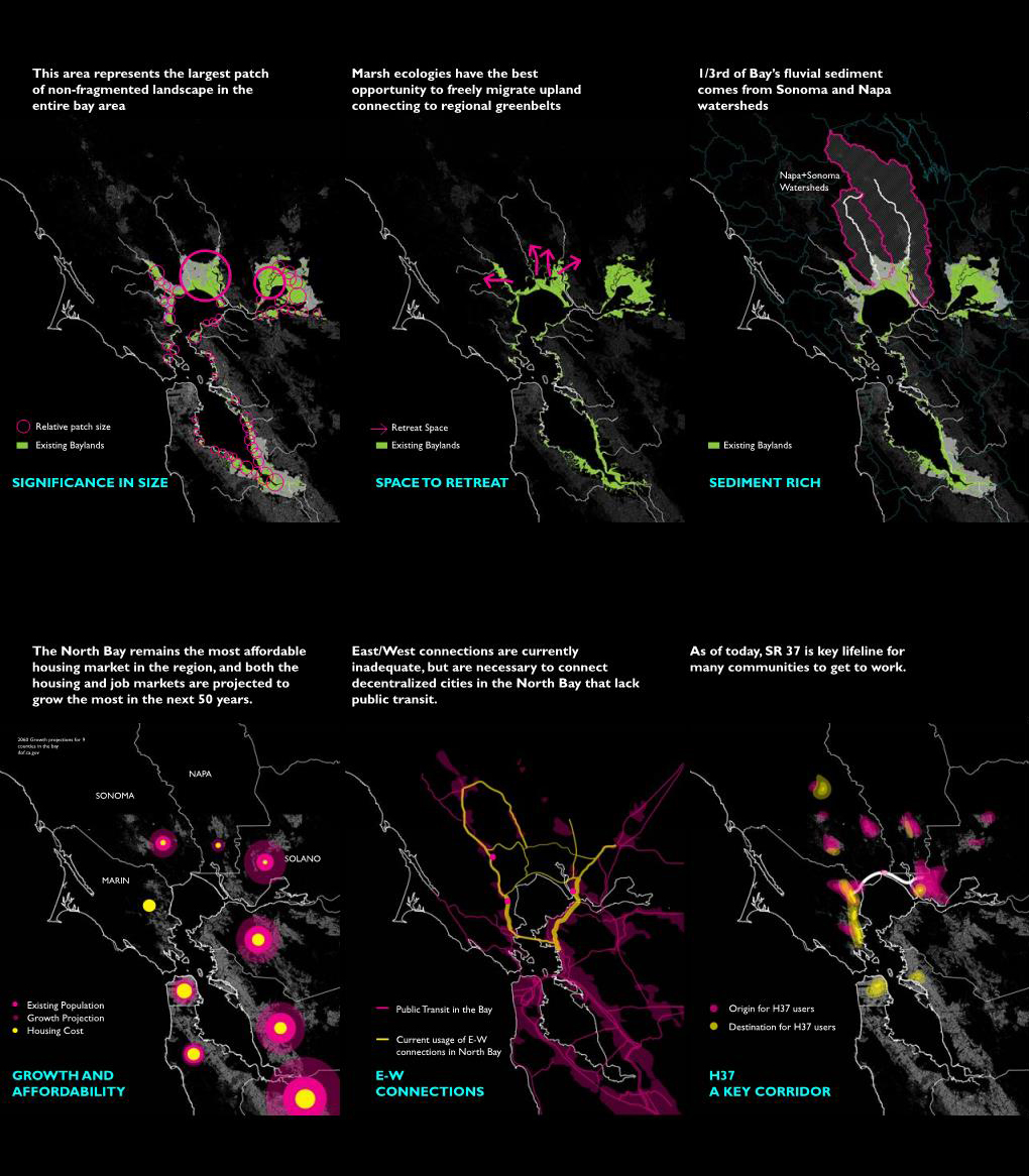
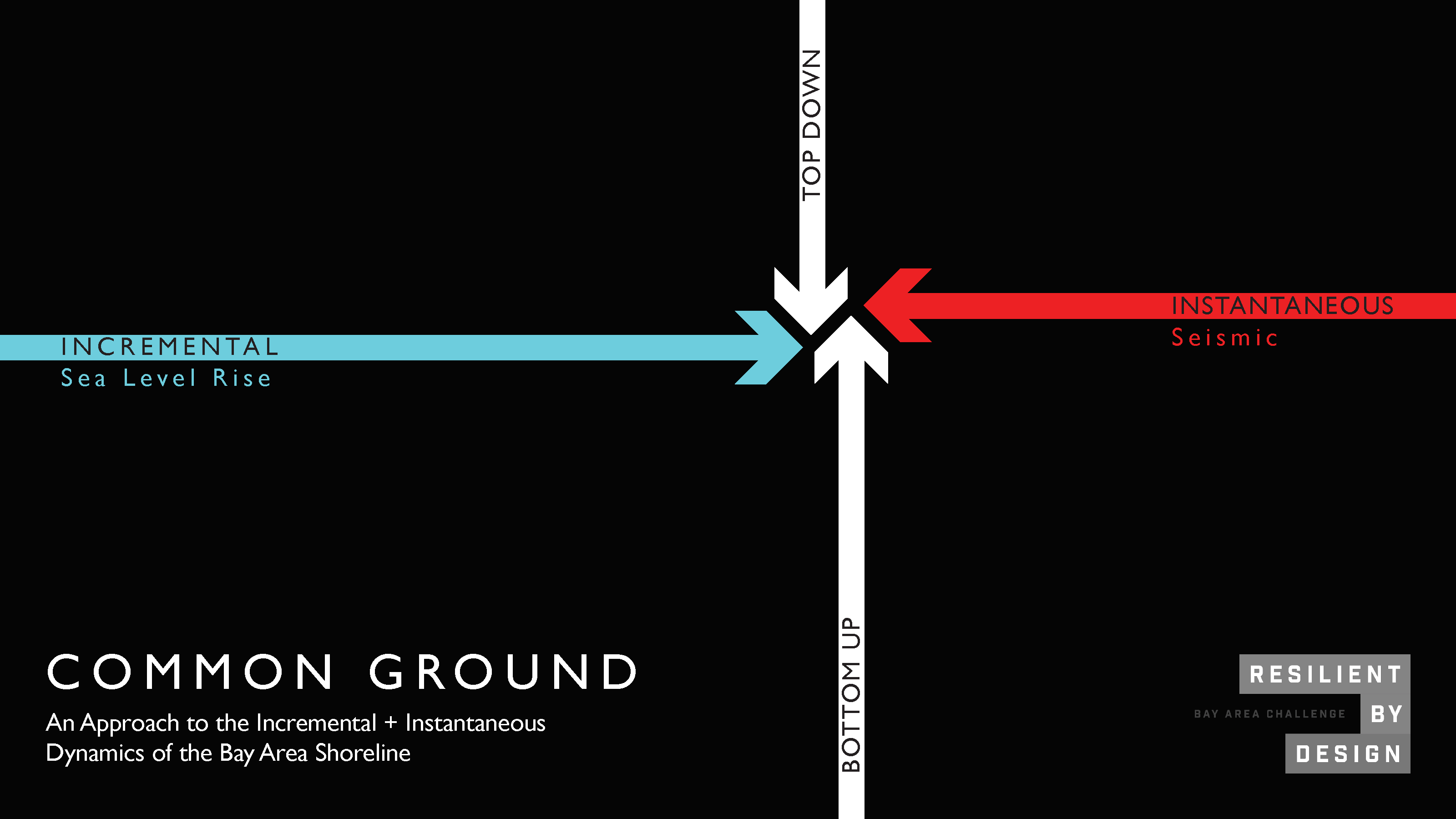
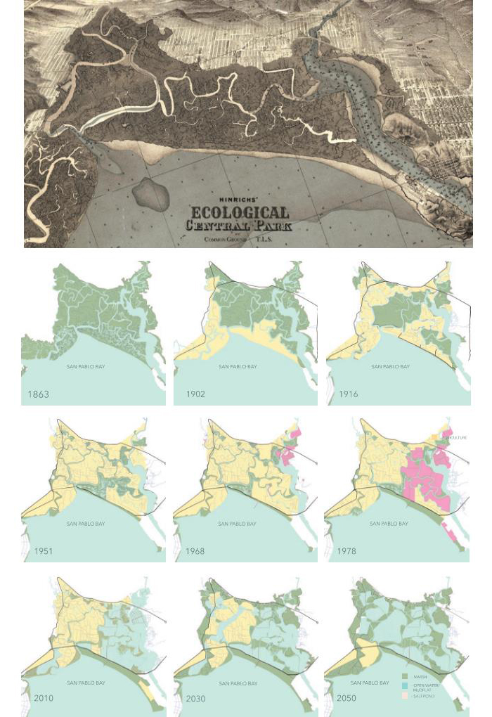
The Common Ground team was first charged with understanding the complexity and urgency of addressing the issues with highway 37. The intricacies of negotiating among many management plans, grasping complex governance structures, the impending threat of sea level rise, and the upfront costs all pose significant challenges and present hard questions for planning a multi-benefit, long term infrastructure project. As can often be the case with complex challenges, the Common Ground team took the opportunity to ‘make the problem bigger’ to solve it; we expanded the scope to include the entire San Pablo Baylands to the north as a way to contextualize the highway and the surrounding areas at a holistic, ecologically and socially relevant scale.
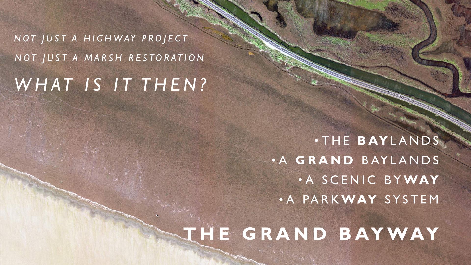
The team worked to understand the surrounding stakeholders and their concerns with the highway planning, as well as the extent of the ecological impact. The “Grand Bayway” came to stand for the regional significance of the entire zone including “flows of people, flows of water”, not just the highway project alone. The expanded holistic scale of planning was recognized as relevant to the MTC and BARC missions within the region, which presented the exciting opportunity to continue and build upon our initial work.
The Grand Bayway identified four guiding principles, derived from the Resilient by Design Goals, the Bayland Report Goals, SR37 Goals from the SR37 Policy Committee Corridor Plan, and a set of Community Goals refined from nine months of regional public outreach, to serve as the backbone for our research The four guiding principles are:
•IDENTITY – Strengthen the identity of the San Pablo Bay Region to encourage a better understanding of the Baylands as a major ecological and educational resource.
•ADAPTING GROUND – Provide new strategies for adaptation of the San Pablo Baylands in response to sea level rise to protect sensitive habitats and maintain critical biodiversity.
•MOBILITY – Create long-term, resilient opportunities to connect across the San Pablo Baylands with discrete inter-modal connections to adjacent communities.
•EXPAND THE CONSTITUENCY – Provide more equitable access to the diverse communities of San Pablo Bay that could broaden the constituency for these Baylands.
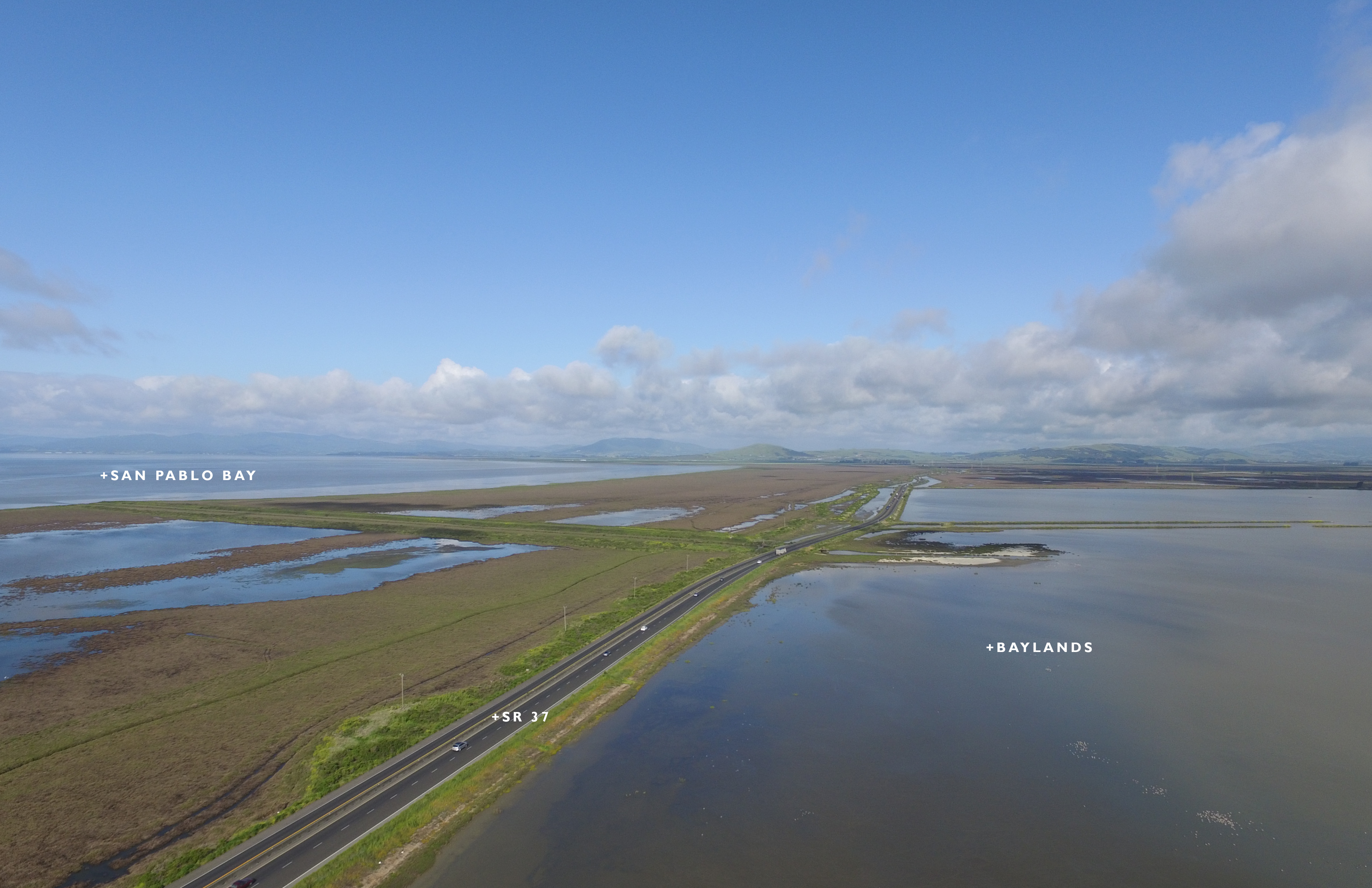
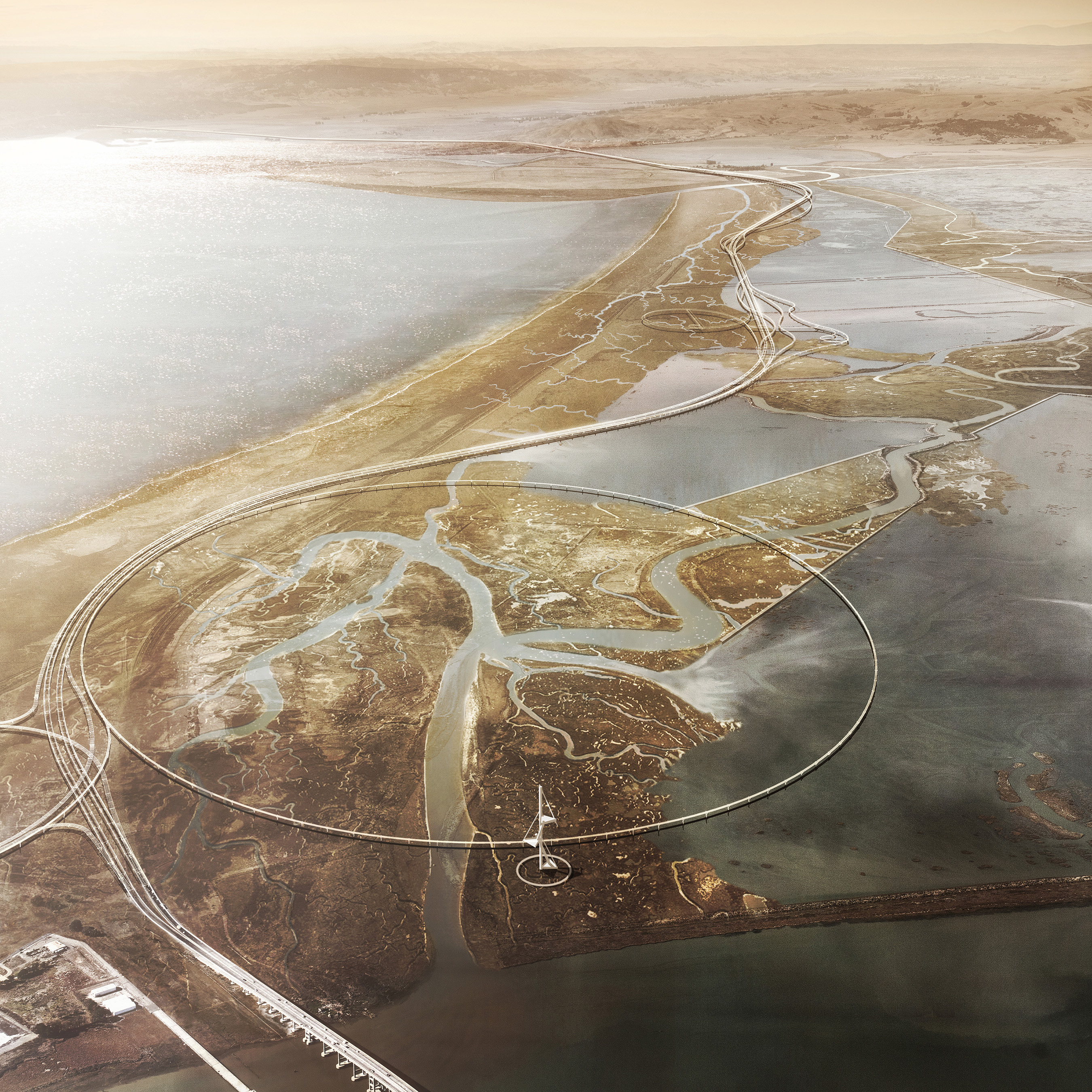
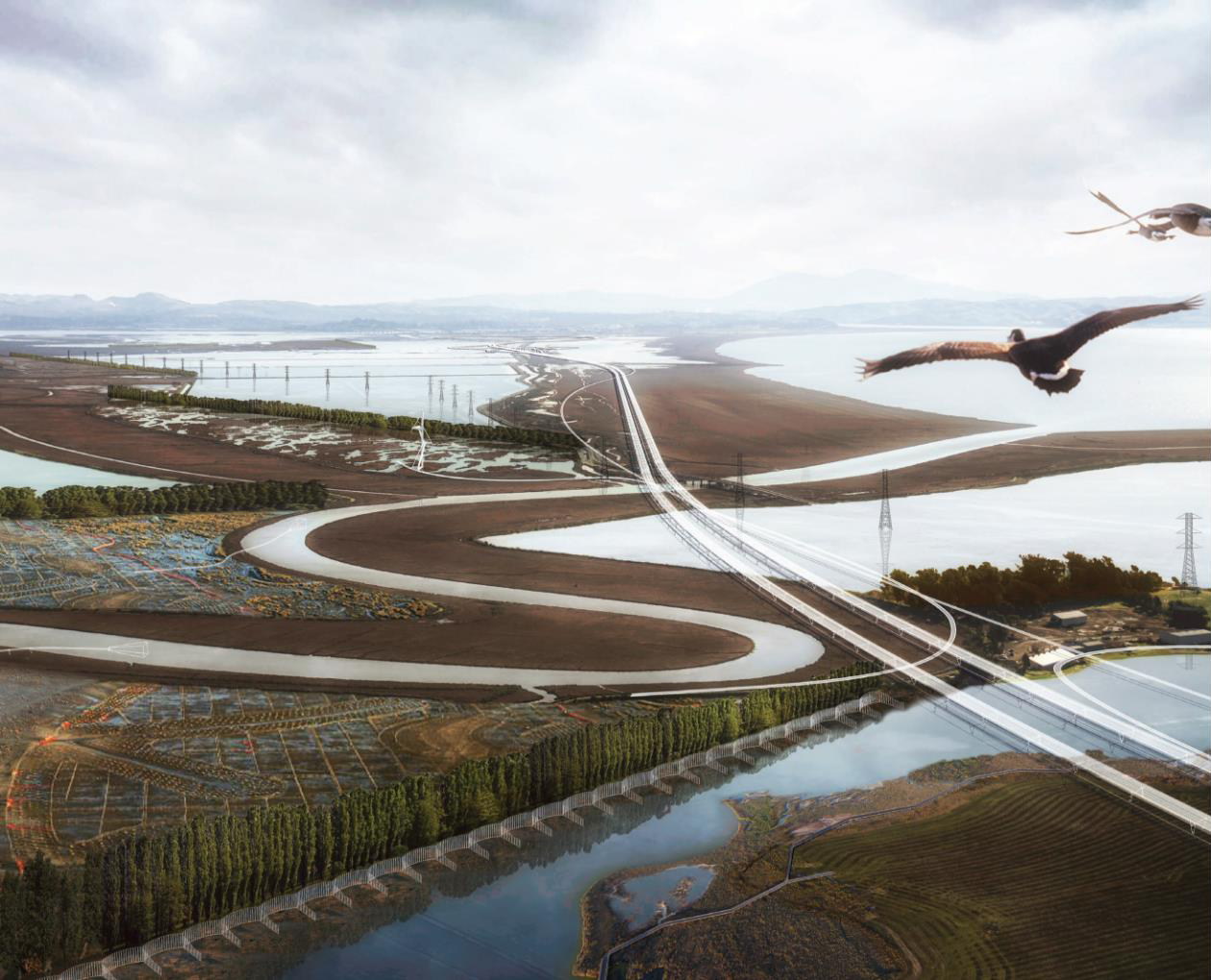
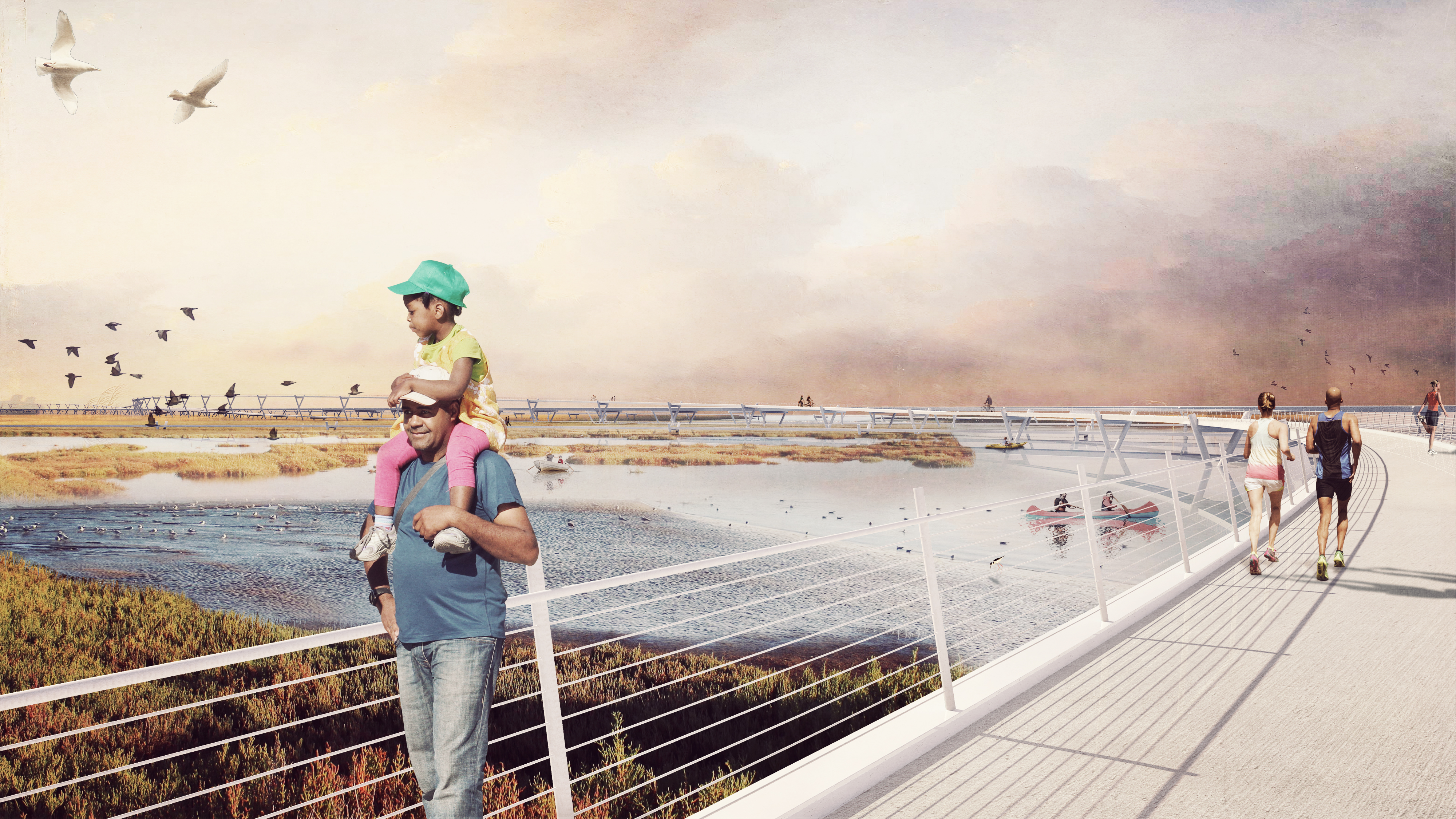
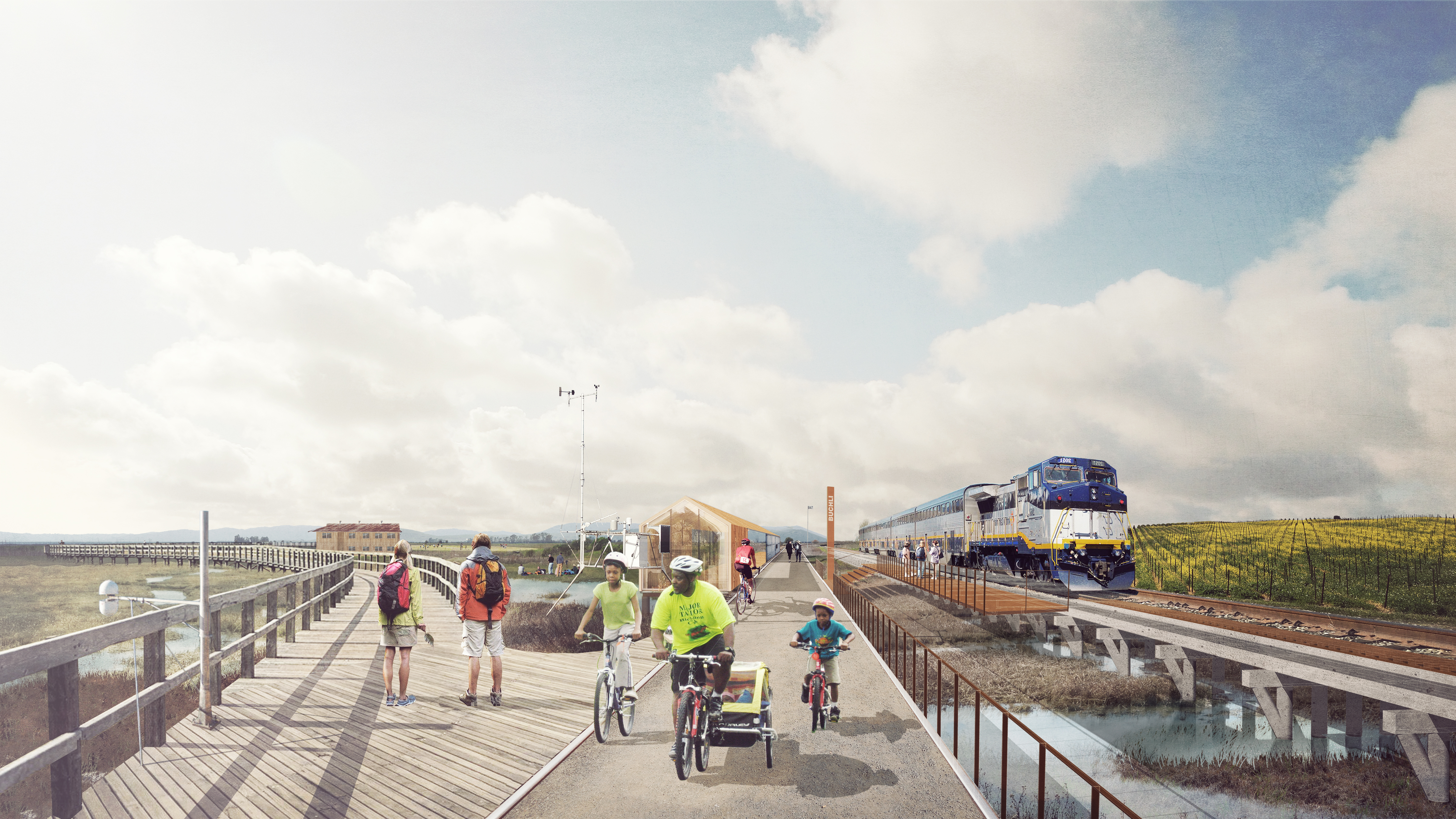
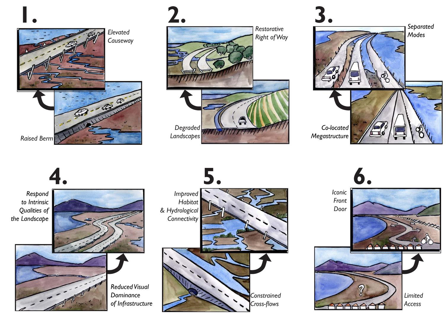
The project proposes to resolve the transportation problem of Highway 37 by designing a scenic causeway and parkway elevated on columns 20 feet high, allowing tidal flows and marsh migration to return to their natural condition. The causeway is designed with the same ambition and flair as other iconic bay crossings but based on 21st-century sensibilities for the natural environment and diverse transit types, not just vehicles. This design is based on the ecological and landscape principles of scenic byways and parkways, curving to open views over the bay and marshes and oriented to natural landmarks while allowing for passage of hydrology and key habitat underneath. Lane directions, as well as the Bay Trail, are “unspooled” and flow independently like the sloughs they traverse, creating access to open space below. This level of investment in design and visibility for an ecological “Central Park” will return major value for the region, its identity, and its future.
A great mobility loop will encompass the open space involving pedestrian and bike routes collocated with an excursion train using an existing freight line. Integral to the concept of a loop is to provide multi-modal, redundant means to travel through the area should SR37 be closed due to flooding or a seismic event. The huge Baylands complex is of course inextricably linked to the resolution of the highway. To prepare for rising sea levels, the project proposes to create an ecological laboratory working strategically with streams and diked sloughs to incrementally re-engage sediment deposits and cultivate biodiversity through various means including “sediment trains,” hyper-accretion gardens, and floating wetlands.